

Port of Mongla: Bangladesh's Growing Second Seaport
Mongla Port, Bangladesh's rapidly expanding second-largest seaport, is strategically located in Bagerhat District, approximately 48 km south of Khulna City. Situated near the confluence of the Pasur River and the Bay of Bengal, it handles diverse cargo — bulk commodities, project cargo, vehicles, and containers — while helping ease congestion at Chittagong Port.
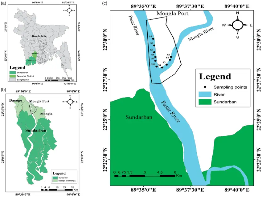
Strategic Location & Regional Connectivity
Positioned on the east bank of the Pasur River, 71 nautical miles upstream from the Bay of Bengal, Mongla Port benefits from a sheltered location safeguarded by the Sundarbans, a UNESCO World Heritage site. Ongoing rail link and terminal expansion projects continue to strengthen its contribution to the national economy.
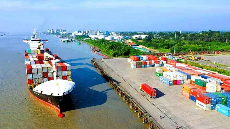
Operational Capabilities & Infrastructure
Draft & Vessel Capacity: Mongla accommodates vessels with a maximum draft of 8.5 meters, subject to tidal variation of 2.5–5.5 meters, handling ships up to 200 meters LOA and 30,000–40,000 DWT.
Infrastructure Improvements: Capital dredging of the Pasur Channel is underway, targeting a 10-meter depth by 2026. Jetty No. 9 was completed in 2023, and a modern container terminal is projected to handle 500,000 TEUs by 2027.
Maximum Vessel Size by Cargo Type
LOA 170 meters, draft 7.5 meters. Handles heavy machinery, steel coils, and construction equipment as project cargo.
Bulk: LOA 183 m, draft 6.5 m. Tankers: LOA 120 m, draft 5.5 m. Gas: LOA 120 m, draft 6.0 m. Bulk cargo includes cement clinker, coal, gypsum, fertilizer, and food grains.
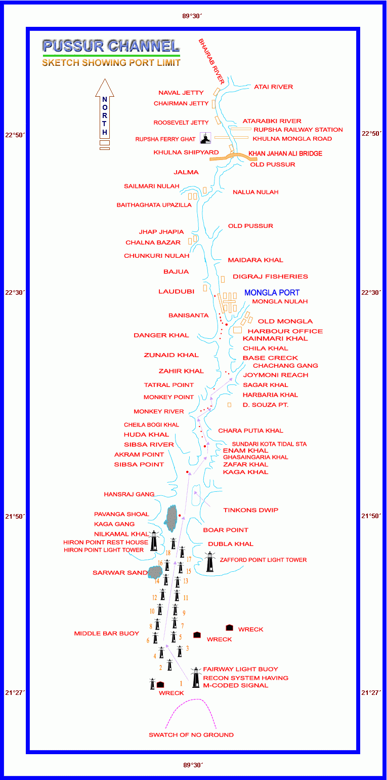
Navigational & Tidal Information
Vessels with drafts of 6.0 to 9.5 meters can berth at anchorages, mooring buoys, and jetties. Maximum vessel LOA is 225 meters (150 meters for night navigation). The tidal range follows a semi-diurnal cycle between 2.5 and 5.5 meters. Pilotage is mandatory for vessels exceeding 100 meters LOA, with pilots boarding at Hiron Point or Fairway Buoy. The channel is marked by 64 lighted buoys — conical shapes indicate port side, other shapes indicate starboard.
Hydrographic & Anchorage Details
The port experiences semi-diurnal tides with a noticeable diurnal effect, critical for crossing the shallow outer bar at the entrance. Mongla provides shore-based facilities and a sheltered anchorage in the Pasur River, with water depths ranging from 5.9 to 17.0 meters at Lowest Low Water Datum. The distance from Mongla Fairway buoy to Mongla Port Jetty is 71 nautical miles, and the outer anchorage at Hiron Point supports vessels awaiting favorable tide windows.
Cargo Handling & Ship Size
In 2024, Mongla Port handled 14.5 million tons of cargo, a 10% increase from 2023. Major commodities include cement clinker, fertilizer, coal, and food grains, alongside significant growth in jute and garment exports. Vessels with drafts up to 9.5 meters can cross the bar year-round, with vessels up to 10.5 meters crossing during spring tides in the southwest monsoon season.
Additional Services & Information
Charts: Digital (BD307425, BD407426, BD57451A, BD57451B, BD57452A, BD57452B); Paper (BA IN351, US 63320). Publications: NP21, Bay of Bengal Pilot.
Fuel & Bunkering: Compared to Chittagong, bunker fuel availability is limited, primarily MGO and IFO via barges, arranged with notice through Mongla Port shipping agents.
Airports: Jessore Domestic (112 km); Chittagong International (180 km).
Digitalization: The Mongla Port Authority (MPA) introduced an online vessel tracking and booking system in January 2025.
Green Port Initiative: Plans are in place to install solar-powered cranes and reduce emissions by 2026.
For more details, visit the Mongla Port Authority Website.